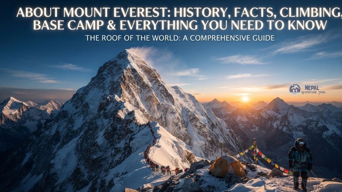
The measurement came first, and it was done with arithmetic rather than boots. In the 1850s, surveyors working through the Great Trigonometrical Survey of India ran their calculations on a distant snow peak catalogued only as Peak XV. The numbers said it was higher than anything else on Earth. Nobody had climbed it. Nobody had been close, because Nepal was closed to outsiders and Tibet was difficult to enter. The world’s highest mountain was identified before a single person stood on it.
That sequence tells you something about Everest. It is a geographic fact, a border, a measurement, a place with names in several languages, a home to the Sherpa people of the Khumbu, and a stage for some of the most demanding mountaineering ever attempted. This guide covers all of it, from where the mountain sits and how tall it is, through its history, the people who made climbing it possible, the risks, the environmental pressure, and what a traveller can realistically do there today. It is the long answer to the question behind “about Mount Everest.”
What Is Mount Everest?
Mount Everest is the highest mountain on Earth above sea level. It rises in the Mahalangur Himal, a sub-range of the Himalayas, on the border between Nepal and the Tibet Autonomous Region of China. Its summit stands at 8,848.86 m (29,031.7 ft) in the figure announced jointly by Nepal and China in 2020.
Height above sea level is the usual yardstick, and it is the one Everest wins. Other measures, such as height from base to peak, favour other mountains. The point is not to diminish Everest. It is to remember that “highest” is a specific claim, and that the mountain is part of a crowded high range that includes Lhotse, Makalu and Cho Oyu, four of the six highest peaks in the world.
Where Is Mount Everest Located?
The summit lies on the international boundary between Nepal and Tibet, so the mountain has a southern side in Nepal and a northern side in China. On the Nepal side it falls in the Khumbu region of Solukhumbu District, Koshi Province, inside Sagarmatha National Park. On the Tibet side it falls in Tingri County, Xigazê (Shigatse) Prefecture.
Its coordinates are about 27°59′17″N, 86°55′31″E. Kathmandu is to the west-southwest, roughly 140 to 160 km in a straight line depending on the source, but no road reaches the Nepal side. Everest is often described as a Nepali mountain because the classic trekking and climbing approach starts in Nepal and the Nepali name, Sagarmatha, is the official Nepali designation. The accurate sentence is that Everest stands on the Nepal-Tibet border, not entirely in either country. For a fuller geographical breakdown, see our guide to where Everest is located.
How High Is Mount Everest?
The accepted height is 8,848.86 m (29,031.7 ft), based on the joint Nepal and China measurement announced in 2020. Nepal Tourism Board pages and many older sources still use the rounded 8,848 m, which comes from an Indian survey in the 1950s.
The history of the number is a story about method. Radhanath Sikdar, an Indian mathematician working for the Survey, calculated in 1852 that Peak XV was the highest peak. The result was announced in 1856 as about 8,840 m (29,002 ft). A survey in the 1950s refined it to 8,848 m, and a GPS-based measurement in 1999 reported about 8,850 m. The 2020 figure came from combined Nepali and Chinese work. Surveyors measure from sea level using trigonometry and satellite positioning, and differences come from what they treat as the top, snow or rock, and from the models used to define sea level. The difference between figures is a matter of metres, not a dispute about which mountain is highest.
What Are the Other Names of Mount Everest?
Three names dominate. Sagarmatha is the Nepali name, commonly translated as peak of heaven or forehead of the sky. Chomolungma, written Qomolangma in Chinese romanisation, is the Tibetan name, often rendered as Holy Mother or Goddess Mother of the World. Everest is the English name, and it is the result of a survey decision, not local usage.
Sir Andrew Waugh, the British Surveyor General of India, argued that the mountain had too many local names for him to choose among them. He proposed naming it for his predecessor, Sir George Everest, in the 1850s, and the name was adopted in 1865. Everest himself pronounced his surname “EVE-rest,” which differs from the usual pronunciation today. Each name reflects a different relationship with the mountain. For Sherpa and Tibetan communities it is a sacred presence, and for the British survey it was a coordinate.
A Brief History of Mount Everest
From Peak XV to Mount Everest
The Great Trigonometrical Survey mapped the subcontinent over decades, observing high peaks from far away in the plains. Peak XV was one of many catalogued points. Sikdar’s calculations in 1852 showed it to be the highest, and the 1856 announcement placed it above Kangchenjunga, which had previously been thought highest. The naming followed in 1865.
Early Everest Expeditions
Climbing began from the Tibetan side because Nepal was closed to foreigners. A British reconnaissance expedition in 1921, with George Mallory among its members, explored the northern approach. The 1922 expedition went higher, using bottled oxygen for the first time, and an avalanche killed seven porters. A third expedition followed in 1924.
Mallory and Irvine’s 1924 Expedition
On 8 June 1924, George Mallory and Andrew “Sandy” Irvine were last seen climbing high on the northeast ridge, then disappeared. Mallory’s body was found in 1999. In 2024, a boot and sock were recovered and reported as belonging to Irvine, which reopened discussion about the pair’s last hours.
Whether they reached the summit is unknown. There is no confirmed evidence either way, and any claim that they did or did not is a theory. Mallory’s reply when asked why he wanted to climb Everest, “Because it’s there,” remains the most quoted line in mountaineering.
The Historic 1953 First Ascent
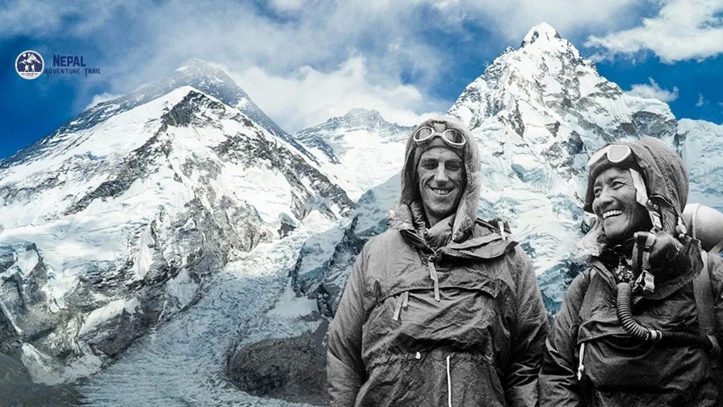
On 29 May 1953, Edmund Hillary of New Zealand and Tenzing Norgay, a Sherpa mountaineer, reached the summit as part of a British expedition led by John Hunt. It was the first confirmed ascent. They climbed from the south, from Nepal, using the South Col route.
The achievement belonged to a team. Climbers, Sherpa porters and support staff built camps, carried loads and prepared the route. Tenzing Norgay’s role as a full partner is part of the record, and the story of “two men” simplifies a larger effort.
Mount Everest and the Sherpa People
The Sherpas are an ethnic group of the high valleys of eastern Nepal, including the Khumbu. Their communities are Buddhist, and their relationship with the mountains is cultural and spiritual as well as economic. The word “Sherpa” names a people, not a job. Not every high-altitude worker is Sherpa, and not every Sherpa works in mountaineering.
Sherpa climbers carry loads, fix ropes, establish camps, guide clients and perform rescues. Their altitude experience shapes how Everest expeditions work. Kami Rita Sherpa, from Thame in Solukhumbu, reached the summit for a record 32nd time on 17 May 2026, after first climbing in 1994. Sherpas also carry the highest risk. In April 2014, an ice avalanche in the Khumbu Icefall killed 16 Nepali guides, most of them Sherpas, and many boycotted the rest of the season to protest pay and treatment. Western narratives have often centred foreign climbers, which is why recent writing makes a point of putting Sherpa contributions in the foreground.
How Everest Climbing Has Evolved
For decades, Everest belonged to national and small-group expeditions. A few milestones show the shift. Junko Tabei of Japan became the first woman to reach the summit on 16 May 1975. On 8 May 1978, Reinhold Messner and Peter Habeler made the first ascent without supplemental oxygen, which many physiologists had thought impossible. Messner made the first solo ascent in 1980. Polish climbers Krzysztof Wielicki and Leszek Cichy made the first winter ascent on 17 February 1980.
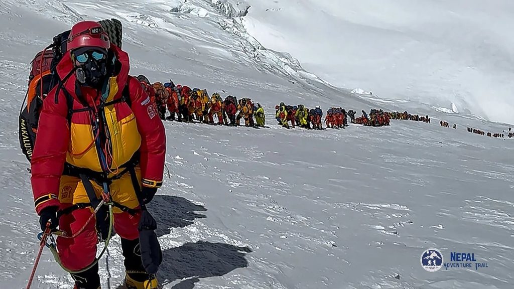
Over time, commercial expeditions grew. Guided teams, fixed ropes, oxygen supply and Sherpa support made the climb accessible to far more people, though it never became easy. The modern season is crowded and heavily managed, with summit windows in May.
Why Is Mount Everest So Difficult to Climb?
Altitude is the central problem. At the summit, the air holds roughly a third of the oxygen available at sea level, and the body cannot acclimatise fully above about 8,000 m. That zone is called the Death Zone, a term for the altitude at which the body deteriorates even while resting, not a place where death is guaranteed.
Beyond thin air, climbers face cold, high winds, steep ice, crevasses, avalanche risk in the Khumbu Icefall, frostbite, exhaustion and rapidly changing weather. An expedition spends weeks acclimatising, moving up and down between camps before a summit attempt. The route follows Base Camp, the Khumbu Icefall, the Western Cwm, the Lhotse Face, the South Col and the final ridge. The difficulty is endurance and judgment more than technical rock climbing.
What Is Everest Base Camp?
Everest Base Camp is a staging area at the foot of the mountain, not the summit. It exists because expeditions need a place to acclimatise, store equipment and rest before attempting the climb. There are two.
South Base Camp is in Nepal, on the Khumbu Glacier in Sagarmatha National Park, at about 5,364 m. It is the base for the South Col route and the destination of the Everest Base Camp trek. North Base Camp is in Tibet, near Rongbuk Monastery, at roughly 5,150 m, reached by road, and it serves the northeast ridge route.
Base Camp is about 3,500 m below the summit. Reaching it is a trek. Climbing Everest is an expedition.
Everest Base Camp Trek: What Travelers Should Know
The Everest Base Camp trek is a teahouse trek, with meals and beds in family-run lodges along the way. The standard route flies from Kathmandu to Lukla (2,860 m), then walks through Phakding, Namche Bazaar (about 3,440 m), Tengboche (about 3,860 m), Dingboche (4,410 m), Lobuche (4,910 m) and Gorak Shep (about 5,164 to 5,180 m, depending on the source). Many trekkers also climb Kala Patthar (about 5,545 m; sources vary) for the clearest views of Everest.
The trek usually takes about 12 to 14 days. Acclimatisation days at Namche and Dingboche are part of the plan, not a bonus. Trekkers need steady fitness, proper boots and layers, and the willingness to turn back if symptoms worsen. Flights from Lukla depend on weather, and in peak months they have often operated from Manthali in Ramechhap, so confirm arrangements.
On permits, published figures list a Sagarmatha National Park permit at about NPR 3,000 and a Khumbu local municipality fee of NPR 2,000 to 3,000. TIMS and guide requirements are reported differently by different sources, so check with the Nepal Tourism Board or a registered operator. Many sources describe a licensed guide as required on major routes since 2023. For the best months, spring and autumn are the main trekking seasons, with autumn often offering clearer skies. See the Everest Base Camp trek and best time to trek in Nepal for trip planning.
Everest Base Camp Trek vs Climbing Mount Everest
| Factor | Everest Base Camp Trek | Mount Everest Expedition |
|---|---|---|
| Objective | Reach the Base Camp area and Kala Patthar | Reach the 8,848.86 m summit |
| Highest altitude | About 5,364 m at Base Camp; about 5,545 m at Kala Patthar | 8,848.86 m |
| Technical difficulty | Trail walking, no climbing skills | Ice, ropes, crevasses, high-altitude climbing |
| Duration | About 12 to 14 days | Roughly two months |
| Permits | Park permit, local fee, trekking rules | Climbing permit; spring royalty for foreigners on the south route is US$15,000 from September 2025 |
| Cost | Moderate | Tens of thousands of US dollars |
| Risk | Altitude illness is the main concern | Avalanche, exposure, altitude and high mortality risk |
| Support | Guide and porters common | Expedition team, oxygen, Sherpa support |
The Everest Region and Sagarmatha National Park
The Everest region, known as the Khumbu, is a landscape of steep valleys, glaciers and high passes. Trails cross suspension bridges above glacial rivers and climb through rhododendron forest at lower elevations before breaking into alpine terrain. Namche Bazaar sits in a horseshoe of hills, Tengboche has a Buddhist monastery with a view across the valley, and Ama Dablam rises as a landmark along the way. Nuptse blocks the view of Everest from much of the region, so the summit is not always visible from the trail.
Sagarmatha National Park protects the Nepal side. It was established in 1976 and added to the UNESCO World Heritage list in 1979. It holds Sherpa communities, monasteries, glaciers and high alpine habitat, and wildlife that includes Himalayan tahr and musk deer. Conservation matters here because the park is both a protected ecosystem and a heavily visited trekking route.
Weather and Best Time to Visit Everest
The best season to climb and the best season to trek overlap but are not the same. Climbers aim for a narrow window in May, when the high-altitude winds that scour the summit usually ease before the monsoon. Trekkers favour spring (March to May) and autumn (late September to November). Autumn often brings clearer post-monsoon skies, while spring brings rhododendrons on the lower trail and more haze. Monsoon brings cloud, rain and unreliable flights. Winter is cold, with snow and short days, though it is quiet.
Temperature drops with altitude, roughly 6°C for every 1,000 m as a broad rule. At the summit, conditions are severe in any season, and weather can change quickly.
Major Everest Risks and Disasters
Three events shaped how mountaineers think about risk. On 10 and 11 May 1996, a storm trapped climbers high on the mountain, and eight died, which raised questions about crowding and commercial pressure. On 18 April 2014, an ice avalanche in the Khumbu Icefall killed 16 Nepali guides, the deadliest single event until the following year. On 25 April 2015, an earthquake triggered an avalanche that swept into Base Camp, killing at least 19 people, with some tallies higher.
These events taught specific lessons. Weather judgment and turnaround times matter. The Icefall is a persistent hazard for the people who cross it most often. Base Camp is not immune from natural hazards. Rescue is limited at extreme altitude. More recently, the 2023 season recorded 17 or 18 deaths depending on the count, one of the deadliest on record.
Environmental Challenges on Everest
Everest has an environmental problem, and the honest version is more specific than a slogan. Decades of expeditions left waste at camps, including oxygen cylinders, tents, food packaging and human waste. Climate change adds pressure, because melting ice exposes previously buried debris.
Nepal has responded with rules and fees. Since 2014, climbers above Base Camp must bring back at least 8 kg of solid waste or lose a US$4,000 deposit. Since 2024, climbers above Base Camp have been required to use waste bags for human waste, under the Sagarmatha Pollution Control Committee and Khumbu Pasang Lhamu Rural Municipality. The committee reported clearing about 85 tonnes of garbage in the 2024 spring season, including nearly 28 tonnes of human waste. A recent study reported rising surface temperatures at Base Camp, and the idea of moving the camp lower has been discussed and has met local opposition. Waste figures and rules continue to change, so treat any single number as a snapshot.
Major Mount Everest Records and Achievements
- First confirmed ascent: Edmund Hillary and Tenzing Norgay, 29 May 1953.
- First woman: Junko Tabei, 16 May 1975.
- First without supplemental oxygen: Reinhold Messner and Peter Habeler, 8 May 1978.
- First winter ascent: Krzysztof Wielicki and Leszek Cichy, 17 February 1980.
- First solo ascent without oxygen: Reinhold Messner, 1980.
- Most summits: Kami Rita Sherpa, 32 ascents, most recently on 17 May 2026.
On numbers, the Himalayan Database listed roughly 13,700 successful ascents by about 7,500 individuals through the end of 2025, with 339 recorded deaths, though different compilations vary slightly. Reports for the 2026 spring season describe a record of more than 1,000 summits. These statistics change every year, so cite the date when you use them.
Interesting Facts About Mount Everest
- Radhanath Sikdar’s calculation in 1852 identified Everest as the highest peak before anyone had climbed it.
- The English name is pronounced “EVE-rest” by the man it honours, not “EV-rest.”
- The nearest sea to the summit is the Bay of Bengal, almost 700 km away.
- From Lukla, the climb to the summit involves about 6,000 m of elevation gain.
- Everest is not the dominant peak from every viewpoint, because Nuptse and Lhotse block the view from large parts of the trail.
- Kami Rita Sherpa first summited in 1994 and has climbed it nearly every year since, some years twice.
Common Misconceptions About Everest
- “Everest is entirely in Nepal.” It stands on the Nepal-Tibet border.
- “Base Camp is near the summit.” It is about 3,500 m lower.
- “Climbing Everest is just walking uphill.” It involves ice, altitude and weather risk.
- “Sherpas are just porters.” They are guides, rope-fixers and expedition leaders as well.
- “Everest is open all year.” Seasons and weather limit access.
- “Reaching Base Camp means you climbed Everest.” The trek and the climb are different things.
Why Mount Everest Matters to Nepal
Everest is part of Nepal’s national identity and a major draw for tourism. It supports local economies in the Khumbu through lodges, guiding and expedition work, and climbing royalties and park fees contribute to public revenue. It also places responsibility on Nepal for conservation, safety and the welfare of the Sherpa communities whose work sustains the industry. Tourism brings income and pressure in equal measure.
How Can You Experience Mount Everest?
There are several realistic options. The Everest Base Camp trek is the main way to experience the region on foot. Everest region treks such as Gokyo or the Three Passes offer alternatives. Scenic mountain flights and helicopter tours offer a short aerial view, and some trekkers choose a trek with a helicopter return. Mountaineering expeditions are a separate, far more demanding undertaking. On the Tibet side, access is by road with a Chinese visa and permits arranged through an agency. Nepal-side rules change, so verify current requirements before booking.
Plan Your Everest Adventure with Nepal Adventure Trail
Learning about Everest’s history, people and risks tends to change how a visit feels. The mountain looks different once you know what the Khumbu Icefall is, or who built the camps. Travellers who want to experience the region on foot can explore a properly planned Everest Base Camp trek with Nepal Adventure Trail, which can help with guided itineraries, local support and trip planning for the Everest region, including customised schedules.
Frequently Asked Questions About Mount Everest
Where is Mount Everest located?
Mount Everest is in the Himalayas on the border between Nepal and the Tibet Autonomous Region of China. The southern side is in Solukhumbu District, Koshi Province, Nepal, within Sagarmatha National Park. The northern side is in Tingri County, Tibet.
How high is Mount Everest?
The accepted height is 8,848.86 m (29,031.7 ft), based on the joint Nepal and China measurement announced in 2020. Many sources still use the older rounded figure of 8,848 m, and the difference is a matter of metres.
Why is Mount Everest famous?
It is the highest mountain on Earth above sea level, and its climbing history, including the 1953 first ascent and the 1996 disaster, made it a symbol of human endurance. It is also central to Sherpa culture and Nepal’s tourism.
What is Mount Everest called in Nepal?
Sagarmatha, commonly translated as peak of heaven or forehead of the sky. It is the official Nepali name, and Sagarmatha National Park carries it.
What is Mount Everest called in Tibet?
Chomolungma, written Qomolangma in Chinese romanisation, often rendered as Holy Mother or Goddess Mother of the World. It reflects the sacred status of the mountain in Tibetan Buddhist culture.
Who first climbed Mount Everest?
Edmund Hillary of New Zealand and Tenzing Norgay, a Sherpa mountaineer, reached the summit on 29 May 1953 as part of a British expedition led by John Hunt. The 1924 attempt by Mallory and Irvine remains unresolved.
How difficult is it to climb Mount Everest?
Very difficult. Thin air, cold, wind, avalanche risk and exhaustion all apply, and the expedition lasts weeks. It requires serious mountaineering experience, strong fitness and a well-supported team, though it is not a technical rock climb.
How dangerous is Mount Everest?
The Himalayan Database recorded 339 deaths through 2025, and further deaths in 2026. Risk varies with season, route and experience. Avalanche, altitude illness and exposure are the main causes, and no statistic removes the risk.
What is Everest Base Camp?
A staging area at the foot of Everest used by expeditions. There is a South Base Camp in Nepal at about 5,364 m and a North Base Camp in Tibet at roughly 5,150 m. Neither is the summit.
How high is Everest Base Camp?
South Base Camp is about 5,364 m and North Base Camp is roughly 5,150 m. Both are far below the summit at 8,848.86 m. Kala Patthar, a trekking viewpoint, is about 5,545 m, though sources vary.
Can anyone trek to Everest Base Camp?
Many people do, but it is a genuine high-altitude trek. Good fitness, acclimatisation days and a guide help, and altitude illness can affect anyone. Check your health with a doctor before committing.
How long does the Everest Base Camp trek take?
Usually about 12 to 14 days round trip from Lukla, including acclimatisation. Shorter itineraries leave less margin, and weather can add days.
What is the best time to visit Everest Base Camp?
Spring (March to May) and autumn (late September to November) are the main seasons. Autumn often brings clearer skies, spring brings rhododendrons and warmer weather, and monsoon and winter are harder.
What is the difference between Everest Base Camp and climbing Everest?
Base Camp is a trek to about 5,364 m. Climbing Everest is a multi-week expedition to 8,848.86 m with ropes, ice, oxygen and far higher risk and cost.
Conclusion
About Mount Everest, the short answer is that it is the highest mountain on Earth, standing on the Nepal-Tibet border. The longer answer includes survey mathematics, three names for one mountain, an unresolved 1924 mystery, a first ascent that was a team effort, and communities whose work makes the climbing possible.
It also includes a mountain under pressure from visitors and a warming climate. For most travellers, the best way to meet Everest is not the summit but the trail to Base Camp, with time to acclimatise and look around. If you want to plan that walk, Nepal Adventure Trail can help with the details.