
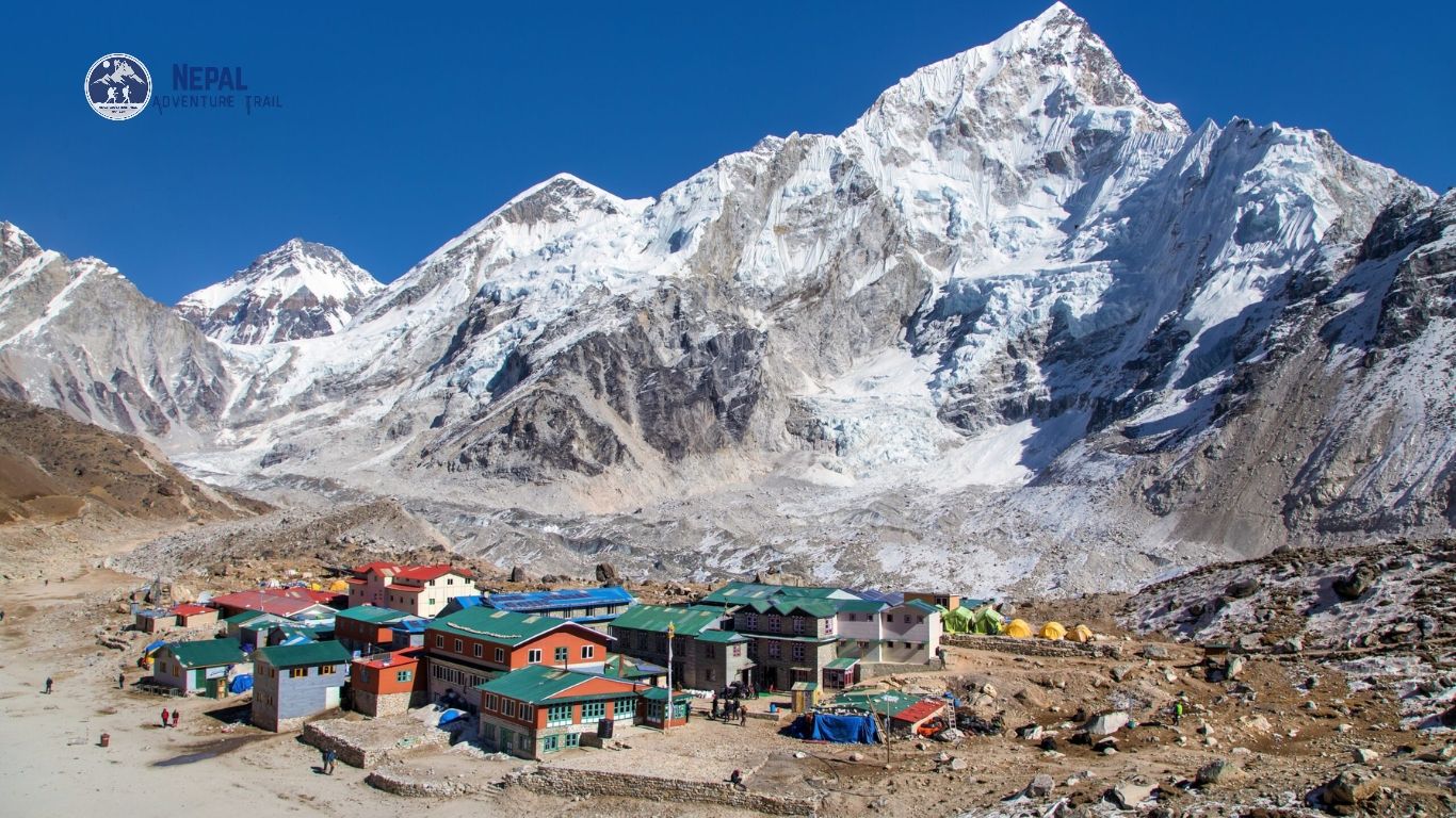
Everest stands on the border between Nepal and Tibet, a pyramid of black rock and blue ice that trails a plume of wind-blown snow off its summit ridge on clear mornings. Its height is 8,848.86 meters. Its reality is harder than its postcard.
This guide covers the geology, the Khumbu approaches, Sherpa history, the crowding problem, and the practical gap between a Base Camp trek and a summit bid. No brochure language. Just the mountain as it is.
The Sacred Peak: Names, Geology, and Tectonic Force
Mount Everest carries three names. Each one tells you who was looking.
Before 1865, British surveyors in India simply called it Peak XV. The name Everest came later, after Sir George Everest, a former Surveyor General of India. He objected to the honor.
Sagarmatha and Chomolungma: The Indigenous Meanings
Chomolungma is the Tibetan name, used for centuries by Sherpa and Tibetan communities on both sides of the peak. Translation is tricky. The popular version is Goddess Mother of the World, though some linguists dispute it.
What does Chomolungma mean to the people who grew up under it? Tenzing Norgay recalled it as the mountain so high no bird can fly over it.
A statement of height, not worship. Tibetan Buddhist tradition places the goddess Miyolangsangma on the mountain, which is why many Sherpas treat Everest as a living presence rather than a trophy. Respect is the entry fee.
Sagarmatha is the Nepali name, adopted in the 1960s and often translated as forehead of the sky. The national park carries it too. Everest, the colonial name, remains the one on most maps.
Sagarmatha National Park, created in 1976 and listed as a UNESCO World Heritage Site in 1979, protects the high valleys around the peak. Tahr graze its slopes. Nepal’s national bird, the danphe, lives here too.
Tectonic Collision: How the Himalaya Keeps Rising
The Indian plate has been driving into Eurasia for roughly 50 million years, and the crumpled crust between them is the Himalaya. The collision never stopped. The range still gains a few millimeters a year.
The summit itself is marine limestone, laid down on an ancient sea floor roughly 450 million years ago. Fossil fragments turn up near the top. The sea became a mountain.
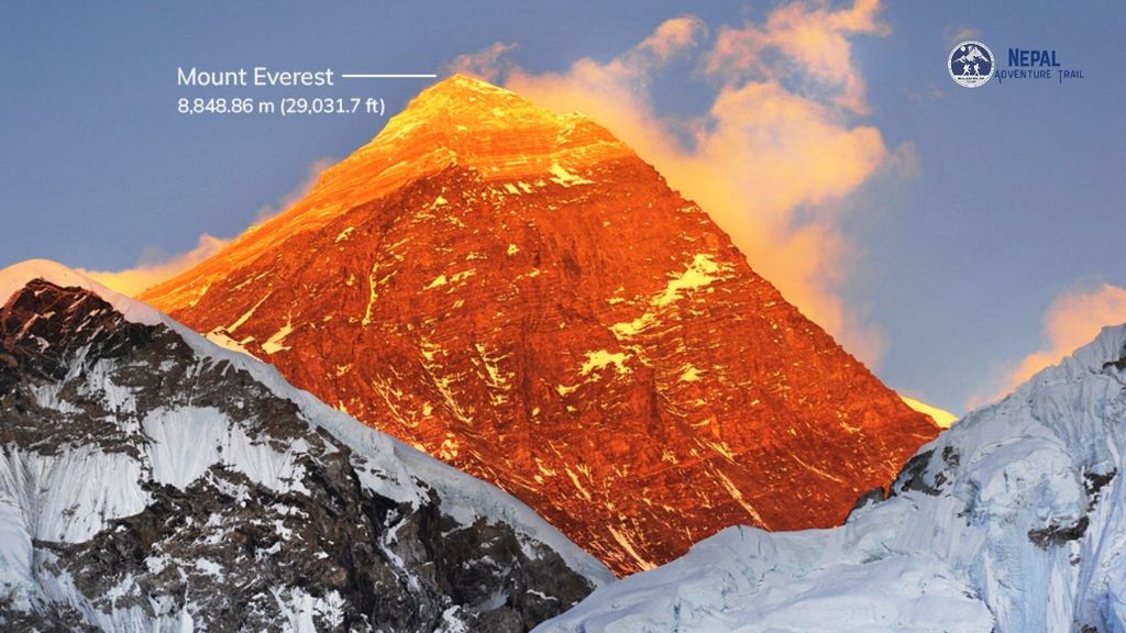
So how tall is Mount Everest today? Since December 2020 the answer has been 8,848.86 meters, about 29,032 feet, as jointly announced by Nepal and China. That settled it.
Earlier figures included 8,848 meters from the 1955 Indian survey and 8,844.43 from a 2005 Chinese measurement. The number includes the snow cap.
Geography of the Khumbu Region and Main Approaches
The Khumbu sits in Solukhumbu District in northeastern Nepal, a landscape of stone-walled villages, rhododendron forest, and glacial moraine that climbs from 2,860 meters at Lukla to the foot of the peak. Everest Base Camp altitude: 5,364 meters. That is higher than any summit in the Alps. The Tibetan side starts lower, near 5,150.
The trek in runs from Lukla through Namche Bazaar at 3,440 meters, Tengboche at 3,867, Dingboche at 4,410, Lobuche at 4,910, and Gorak Shep at 5,164. Every stage trades oxygen for views. Stone steps, yak trains, and suspension bridges fill the days between.
The northern approach goes up the Rongbuk Glacier to a base camp near 5,150 meters, then follows the North Ridge past the Three Steps. Access is controlled by China. Rules shift from year to year.
The South Col Route (Nepal Side)
The Everest South Col route leaves Base Camp, climbs through the Khumbu Icefall to Camp I at about 6,065 meters, then crosses the Western Cwm to Camp II near 6,400. Flat ground. Fierce heat.
The Cwm is a glacial valley walled by Everest, Lhotse, and Nuptse, and sun reflecting off the snow bakes climbers by midday. Nights are brutal.
Above Camp II the route tackles the Lhotse Face, roughly 1,100 meters of blue ice where crampons crunch and the wind off the face stings every exposed cheek, then continues to Camp III at about 7,200 meters and the South Col at 7,906. Fixed ropes carry every step. The South Col is a windswept saddle of rubble and shredded tents.
From the South Col, summit day runs in the dark through the Balcony, the South Summit at 8,749 meters, and the old Hillary Step before the final ridge. Most teams leave late at night. Headlamps bob in a line.
The Hillary Step changed after the 2015 earthquake. Climbers who knew the old rock tower say the route looks different now. The exposure has not changed.
The Khumbu Icefall and Glacier Realities
The Khumbu Glacier moves up to roughly a meter a day through the Icefall, which means the ice is constantly cracking, shifting, and dropping seracs the size of buildings. No route stays the same for long. Icefall Doctors rebuild it.
Aluminum ladders bridge the crevasses, sometimes lashed end to end, and climbers cross them in crampons with the metal bending underfoot. The glacier groans at night. Most teams move through before dawn, when the cold locks the ice.
The Icefall killed 16 Nepali guides in an avalanche on 18 April 2014. It remains the most dangerous stretch of the standard route, and everyone who climbs it knows why. No amount of fitness changes that.
Sherpa Heritage: The Human Engine of High-Altitude Climbing
Sherpa history is not a footnote to Everest climbing. It is the structure holding the enterprise up.
The Sherpa people migrated from eastern Tibet into Solukhumbu roughly 500 years ago, bringing Nyingma Buddhism and an economy of yaks, barley, and potatoes. They had a name already. Then came the surveyors.
The 1953 first ascent made Tenzing Norgay and Edmund Hillary famous, but the expedition rested on dozens of Sherpa load carriers who ferried supplies up the same ridges. Credit has been uneven ever since.
Pasang Lhamu Sherpa became the first Nepali woman to summit Everest, in 1993, and died on the descent. She is a national hero.
Sacred Traditions and the Puja Ceremony
Before anyone steps onto the Icefall, a lama blesses the team at a stone altar at Base Camp, and juniper smoke rolls through rows of yellow tents scattered across the Khumbu moraine. Prayer flags snap overhead. Sherpas on the team often will not climb until the puja is done.
The puja asks permission from Miyolangsangma and requests safe passage for everyone on the mountain. Rice and flour go on the altar. Climbers who treat it as a photo stop miss the point.
On the trail, the same respect applies. Walk clockwise around mani walls and chortens, keeping them on your right.
Tengboche Monastery, founded in 1916 at 3,867 meters, looks straight at Everest, Lhotse, and Ama Dablam, and holds the Mani Rimdu festival each autumn. Stop. Look, then walk on.
Beyond Guiding: The Evolution of High-Altitude Logistics
Modern Everest expeditions run on Sherpa expertise: they fix the ropes, ferry oxygen to the South Col, pitch tents in the wind, and often break trail on summit night. The client gets the photo. The Sherpa team gets the risk.
The industry has changed. Many Sherpa climbers now run their own expedition companies, hold guiding certifications, and lead teams on the world’s biggest peaks. Kami Rita Sherpa holds the record.
He has topped out more than 30 times.
The risk is not evenly shared. Sherpas account for a heavy share of Everest fatalities, because they make the most trips through the Icefall. The 2014 avalanche made that painfully clear.
Modern Realities: Crowding, Weather Windows, and Environment
Nepal issued a record 492 permits for the spring 2026 season, and on good-weather days the line of headlamps below the summit ridge can stretch for hours. Waiting at 8,700 meters burns oxygen. That is the crowding problem in one image.
Foreign climbers on the Nepal side now pay a royalty of $15,000 in spring, up from $11,000 before September 2025. Fees have not thinned the crowd. Check current rules before you plan.
The Brief May Window: Jet Stream Dynamics
For most of the year the jet stream parks over Everest and blasts the summit with winds that can top 160 kilometers per hour. Then it moves.
In May it drifts north for a few days and the summit opens. Everyone wants those days.
The best season to see Mount Everest from the trail is spring, March to May, or autumn, late September to November, when skies are clearest. Monsoon cloud hides it. Winter cold punishes you.
Waste Management, Rope Fixing, and Safety Protocols
Sherpa teams fix the ropes before the clients arrive, a job that takes days and depends on the same weather window everyone is waiting for. Without the ropes, nobody moves.
Waste is a daily reality at altitude. For the 2026 season the Sagarmatha Pollution Control Committee required climbers to bring back at least 8 kilograms of garbage, sort waste by category, and pay a $600 Icefall route fee. Rules change often.
Human waste is its own problem. At Base Camp it is collected and carried out. Higher up, the problem gets harder to manage.
Nepal has also tightened oversight of operators ahead of the 2026 season, including stricter permit checks and more transparency on staffing. Details keep changing.
Experiencing Everest: Summit Expedition vs. Base Camp Trek
How hard is it to trek to Everest Base Camp? Hard in the way a long, cold week of stone steps is hard, not in the way a technical climb is hard.
No ropes. No crampons. Plenty of thin air.
Pick your Everest honestly. If you want to stand under it without a summit permit, trek to Base Camp and climb Kala Patthar. Neither is a small ask.
For the summit, plan on years of mountain experience, a Sherpa-supported team, and a budget well into five figures. Expect to earn it.
Standing at Base Camp (5,364m) vs. Pushing into the Death Zone (8,000m+)
Most trekkers spend about two weeks and cover roughly 130 kilometers round trip, with a flight into Lukla, and the real challenge is acute mountain sickness, which depends on pace rather than fitness. Climb high, sleep low. Rest days matter.
Headache, nausea, and a night of broken sleep are early warnings of altitude sickness. Fluid in the lungs or confusion means descend now. Do not wait for morning.
Base Camp is a tent city on moving ice, loud with cracking glacier by day and silent at night. You cannot see the summit from there. Kala Patthar, at 5,545 meters, gives you the view.
The Death Zone is a different category. Above 8,000 meters the air holds roughly a third of the oxygen found at sea level, the body slowly starves, and judgment erodes. Every minute there is borrowed.
At 8,000 meters, thin, burning air turns each step into a count of breaths, and climbers describe taking several breaths for every footfall on the final slopes. Speed is gone.
More than 300 people have died on Everest since climbing began. Respect the number.
Acclimatization Discipline and Oxygen Logistics
A summit expedition runs about two months, with rotations that take the body up to Camp I or Camp II, then back down to Base Camp to recover. The body adapts slowly. Rushing it fails.
Most climbers use bottled oxygen above Camp III, flowing at several liters per minute, and Sherpa teams stage cylinders at the South Col in advance. The mask hisses with every breath. Regulators can fail in the cold, so teams carry spares.
Climbing without bottled oxygen is a separate discipline. Reinhold Messner and Peter Habeler first did it in 1978. It demands years of high-altitude experience, and even then it can go wrong.
Frequently Asked Questions (FAQ)
How tall is Mount Everest in meters and feet?
Mount Everest is 8,848.86 meters, or about 29,032 feet, in the joint Nepal-China survey announced in December 2020. That is official. The earlier 8,848 meters came from a 1955 Indian survey, and the new figure includes the snow cap.
What is the difference between Sagarmatha, Chomolungma, and Everest?
Everest is the English name from 1865, Sagarmatha is the Nepali name, and Chomolungma is the Tibetan name used by Sherpas. Same mountain. Three viewpoints.
Which country controls Mount Everest?
No single country does. The border between Nepal and the Tibet Autonomous Region of China runs across the summit, so the south side is Nepal’s and the north side is China’s. Each side sets its own rules.
How difficult is it to trek to Everest Base Camp compared to climbing the summit?
A Base Camp trek is a demanding high-altitude walk. A summit climb is a technical, oxygen-dependent expedition lasting about two months. They are different activities that share a mountain.
When is the best time of year to view or climb Mount Everest?
For climbing, the main window is a few days in mid-to-late May. For viewing from the trail, spring and autumn deliver the clearest skies. Plan around the monsoon, which runs roughly June to August.
Why is the Khumbu Icefall considered one of the most dangerous sections?
The Khumbu Icefall is a frozen river moving up to roughly a meter a day, so crevasses open and seracs collapse without warning. Nothing about it is stable. Climbers cross before dawn, ladders bending underfoot, because it cannot be made safe.
Let Us Manage the Route
Understanding the true scale and sacred nature of Everest requires more than reading maps; it demands experienced local guidance, deep logistical planning, and uncompromising respect for the mountain. At Nepal Adventure Trail, we coordinate every detail of your Khumbu expedition or Base Camp trek, ensuring your journey through the highest terrain on earth is safe, culturally grounded, and meticulously executed. Let us manage the route while you focus on the climb.