
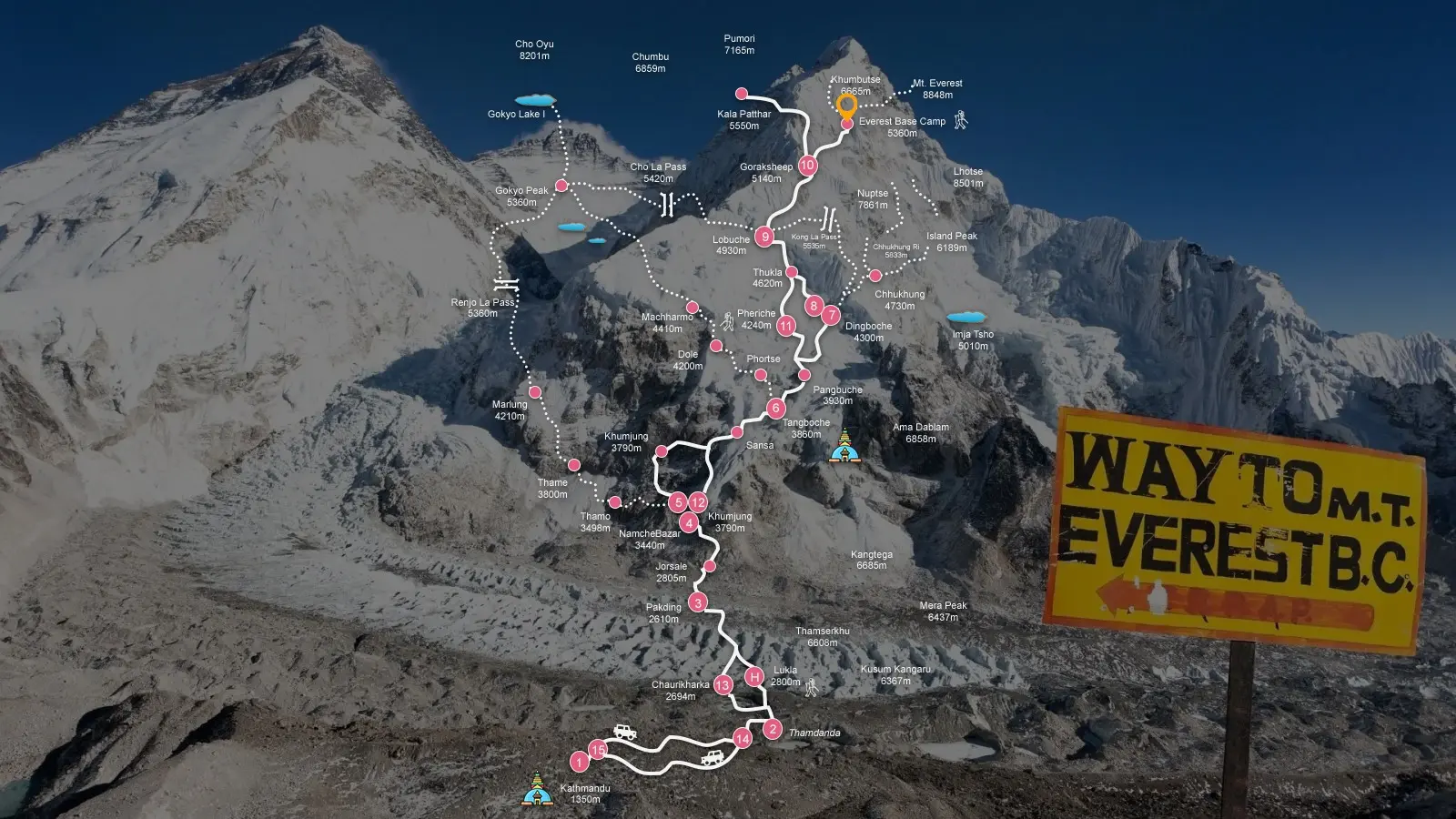
The Everest base camp location sits deep in northeastern Nepal inside the Khumbu region, within Sagarmatha National Park. It is not a roadside destination or a marked viewpoint. It is a high-altitude glacial zone reached only by trekking through mountain valleys, river gorges, and alpine terrain. When people ask where is EBC found, the answer is simple on the map but demanding in reality. It lies at the foot of Mount Everest on a moving glacier, surrounded by some of the highest peaks on Earth.
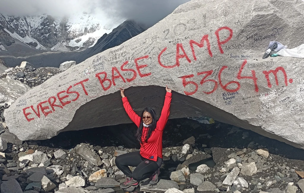
Everest base camp sits at approximately 5,364 meters (17,598 feet) on the lower section of the Khumbu Glacier. This altitude defines everything about the place. Oxygen is reduced by nearly half compared to sea level. Every movement feels slower. Recovery takes longer. The body works harder even when standing still.
The Geography of Everest Base Camp
The geography of Everest Base Camp is shaped by ice, rock, and constant glacial movement. The camp is positioned on the Khumbu Glacier, which flows down from the Western Cwm between Mount Everest and Lhotse. This glacier is not stable ground. It shifts slowly over time, breaking into crevasses, ice ridges, and uneven moraine.
Above the camp rises the Khumbu Icefall, a chaotic wall of ice towers and deep fractures. This section blocks direct access to higher camps on Everest’s southeast route. Surrounding the valley are massive Himalayan peaks including Nuptse, Lhotse, and Pumori. These mountains form a natural bowl that traps cold air and creates harsh, rapidly changing weather conditions.
The altitude of Everest Base Camp at 5,364 meters is critical. At this height, oxygen levels are roughly half of what they are at sea level. The human body does not adapt instantly. Breathing becomes heavier, sleep quality drops, and physical exertion increases significantly.
Sagarmatha National Park Geography
The Everest base camp location lies inside Sagarmatha National Park geography, a UNESCO World Heritage Site covering over 1,100 square kilometers. The park includes deep river valleys, dense forests at lower elevations, and barren alpine terrain at higher levels. As you move upward, vegetation disappears and is replaced by rock, ice, and glacial debris.
The Khumbu valley acts as a natural corridor leading toward Everest. The trekking route to EBC follows this valley upstream along the Dudh Koshi River, gradually climbing through changing ecological zones. Each stage of the trek introduces a different environment, from green forest trails to exposed high-altitude ridges.
The Journey to Everest Base Camp
Reaching Everest Base Camp is not a simple transfer. It is a multi-day expedition on foot. The journey begins with a flight into Lukla at 2,860 meters. From here, the trekking route to EBC moves through a series of settlements and altitude zones that test endurance and acclimatization.
From Lukla, the trail follows the river valley to Phakding and then climbs toward Namche Bazaar. Namche sits at 3,440 meters and serves as the main acclimatization stop. The terrain here becomes steeper and more demanding. The trail climbs in switchbacks, and the air begins to feel noticeably thinner.
From Namche Bazaar, the route continues toward Tengboche at 3,867 meters. The landscape opens into wider mountain views, but the physical effort increases. The trail includes both ascents and descents, which makes pacing important.
Beyond Tengboche, vegetation thins significantly. The path leads to Dingboche at 4,410 meters, where the environment becomes dry and exposed. Cold winds increase, and the landscape transitions into alpine desert-like terrain.
From Dingboche, trekkers move to Lobuche at 4,940 meters. This section runs close to the Khumbu Glacier and introduces rocky moraine fields. Oxygen levels drop further, and fatigue builds more quickly.
The final settlement before base camp is Gorak Shep at 5,164 meters. From here, the trail crosses glacial moraine and unstable rock fields to reach the Everest base camp location. The surface underfoot is uneven, shaped by ice movement and seasonal melt.
How to Reach Everest Base Camp
There are no roads to Everest Base Camp. How to reach Everest Base Camp depends entirely on trekking and weather conditions. The standard approach involves flying to Lukla and then trekking for 12 to 14 days through the Khumbu valley. Some itineraries are longer to allow better acclimatization.
Flights into Lukla are weather dependent and often delayed due to wind and cloud cover. Once in Lukla, the route is entirely on foot through high-altitude terrain. Porters and guides are commonly used, but the trekking itself cannot be avoided.
Facts and Environmental Conditions
The Everest base camp location is not fixed in a permanent sense. The Khumbu Glacier moves slowly each year, which changes the surface and position of the camp area slightly. Expedition teams set up temporary tent cities during climbing seasons, and these are removed afterward.
Weather conditions at this altitude are extreme and unpredictable. Temperatures can drop below -15 degrees Celsius at night depending on the season. UV radiation is strong due to the thinner atmosphere. Winds often increase in the afternoon, making travel more difficult after midday.
The environment is also highly seasonal. The camp is active mainly during spring climbing season and sometimes in autumn. During winter, the area is mostly empty and covered in snow. During monsoon, access becomes difficult due to rain and poor visibility.
Info
The Everest base camp location is not accessible year-round in a practical sense. Winter brings heavy cold and snow, while monsoon season affects flights and trail conditions, making spring and autumn the safest windows.
The distance from Everest Base Camp to the summit is around 20 kilometers in a straight line, but the actual climbing route is far more complex due to the Khumbu Icefall and high camps above.
Sleeping at Everest Base Camp is generally not allowed for trekkers. It functions as an expedition site for climbers with permits. Trekkers usually stay in Gorak Shep or nearby lodges instead.
Temperatures at the base camp location vary widely, with daytime conditions often hovering around freezing or slightly above in peak seasons, and nighttime temperatures dropping well below freezing.
The South Base Camp refers to the Nepal side of Everest, while the North Base Camp is located in Tibet. Both serve different climbing routes to the summit.
The terrain changes significantly with altitude. Lower sections include forests and river valleys, while higher sections become rocky, icy, and completely devoid of vegetation above 5,000 meters.
Final Thoughts
The Everest base camp location is defined by altitude, glacier movement, and remote Himalayan geography. It is not a fixed tourist site but a high-altitude staging area shaped by ice and weather. Reaching it requires days of trekking through the Khumbu valley, careful acclimatization, and awareness of changing terrain conditions.
Knowing the Everest base camp location is one thing; navigating the terrain to get there is another. The Khumbu valley is unforgiving and demands careful planning. At Nepal Adventure Trail, we manage the permits, the logistics, and the safety protocols, so you can spend your energy on the climb, not the coordinates.