
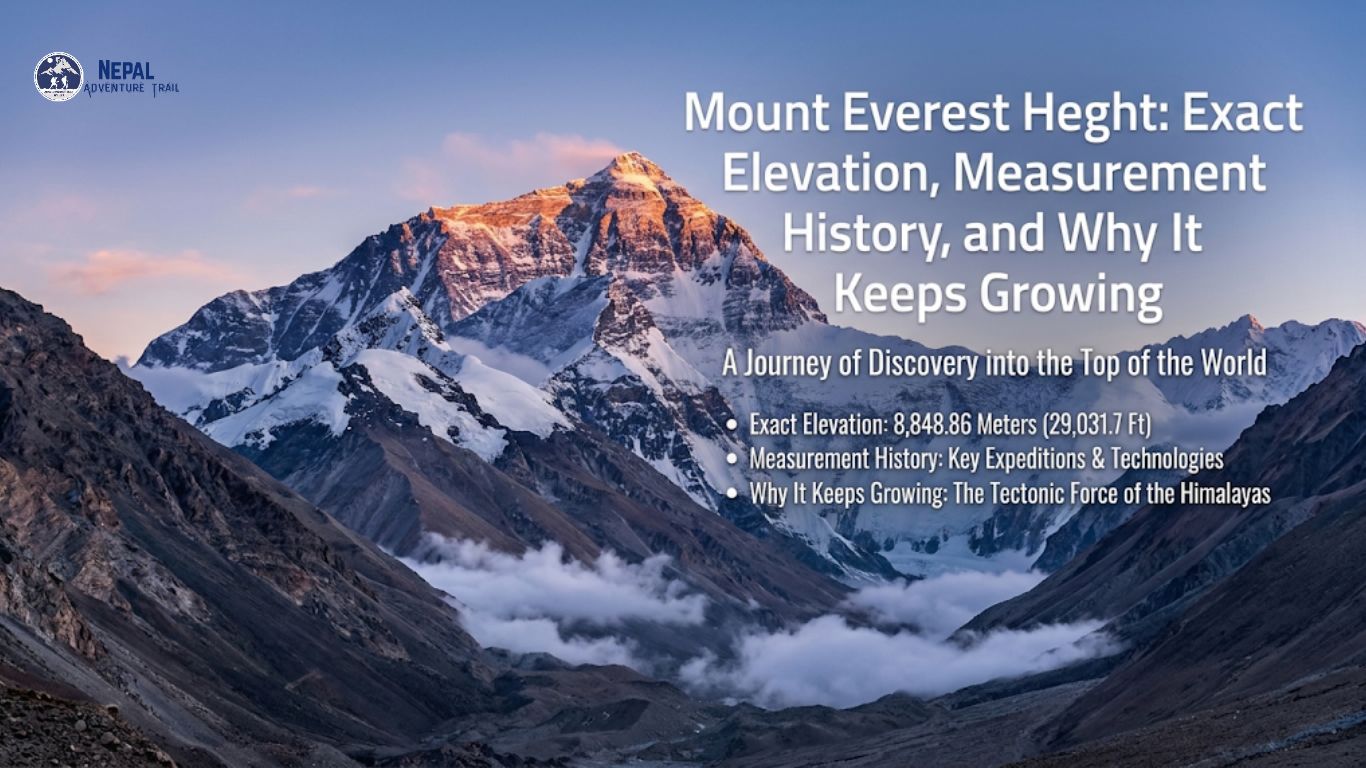
The official Mount Everest height is 8,848.86 meters (29,031.7 feet), a figure that Nepal and China announced together on December 8, 2020. It measures snow, not rock. That distinction matters.
This guide traces how the number was built, from brass theodolites dragged across the malarial Terai to GNSS receivers strapped onto a frozen summit snowpack. It also tackles uplift. Sagarmatha does not sit still.
The Official Numbers: Meters, Feet, and What They Actually Measure
Four different figures for Mount Everest height circulate online, and each traces back to a different survey. They answer slightly different questions. Only one is current and official.
8,848.86 Meters (29,031.7 Feet): Breaking Down the Official Figure
How tall is Mount Everest by today’s standard? The current Mount Everest height is 8,848.86 meters above mean sea level. That converts to 29,031.7 feet. It is 86 centimeters higher than the 8,848-meter figure Nepal had used for decades.
“Sea level” is not a beach in this context. It is the geoid. This gravity-defined surface approximates mean sea level and runs invisibly beneath every continent.
Gravity pulls unevenly, so the geoid rises and falls by tens of meters across the globe. Surveyors cannot see it.
They model it from gravity readings taken on the ground. The Sagarmatha elevation depends on that model being right.
Before 2020, Nepal and China tied their heights to different sea level references. Nepal’s older figure inherited India’s reference. China’s came from the Yellow Sea.
Snow Cap vs. Bedrock Height: The Geodetic Debate
China’s 1975 survey placed the summit snow at 8,848.13 meters. In 2005, Chinese surveyors carried ground-penetrating radar to the top and reported a rock height of 8,844.43 meters, with about 3.5 meters of snow and ice above it. Nepal kept using the snow figure.
The disagreement was practical as much as scientific. Climbers stand on snow, not rock.
The cap thickens after storms and thins under winter wind. It never stays the same twice.
Any honest account of Mount Everest height has to separate the two. Everest rock height vs snow height is not one fixed gap. It moves.
A GNSS antenna planted on the summit reads the snow surface. Radar sees through to the rock. The 2020 figure is a snow-surface height, so the bedrock beneath it sits a few meters lower.
A Century of Surveying: How Humans Measured the World’s Highest Peak
The 1856 Great Trigonometrical Survey and Radhanath Sikdar
Between 1847 and 1850, surveyors of the Great Trigonometrical Survey of India sighted a distant white summit from stations on the hot plains of Bihar, more than 150 kilometers away. They labeled it Peak XV. Malaria thinned their crews.
Their brass theodolites weighed hundreds of kilograms and traveled by cart and porter. Every angle was read, logged, and read again.
Mathematicians then spent years on the arithmetic. They corrected for Earth’s curvature and for light bending through the atmosphere.
Radhanath Sikdar, a Bengali mathematician, led that computing work. The Peak XV results were ready by about 1852.
The popular tale of him rushing into a room to announce the tallest mountain on Earth has no firm contemporary record. His role in the computations does.
Andrew Waugh, the Surveyor General, announced the result in 1856: 29,002 feet, about 8,840 meters. The observations had averaged exactly 29,000 feet. Waugh added two feet so the figure would not look like a guess.
Waugh proposed naming the peak after his predecessor, George Everest, and the Royal Geographical Society adopted the name in 1865. The locals had names already. Tibetans called the mountain Chomolungma. Nepal later adopted Sagarmatha, a name coined by the historian Baburam Acharya.
Modern GNSS puts the peak about 9 meters higher than their value. That is a remarkable result for angles read through a telescope from more than 150 kilometers away.
The 1954 Survey of India (8,848m) and Early Cold War Measurements
The Survey of India revisited the peak in the early 1950s. Observers sighted it from stations across northern India and averaged the results.
In 1954 the survey published 8,848 meters, or 29,028 feet. Nepal adopted it. That value anchored Mount Everest height for decades.
Politics then decided who could measure. After 1950, Tibet’s northern approaches closed to outside surveyors. Nepal’s side opened to foreign expeditions, including the 1953 British ascent.
In 1975, a Chinese team reached the summit and placed a metal survey tripod. They reported 8,848.13 meters.
In 1999, an American team led by Bradford Washburn strapped a GPS receiver to the summit snow and recorded 8,850 meters (29,035 feet). National Geographic adopted that number. Nepal did not.
The 2020 Joint Nepal-China Re-Measurement Mission
Nepal’s Survey Department trained its own surveyors. A team under Khim Lal Gautam reached the summit in May 2019 with GNSS gear.
On May 27, 2020, eight Chinese surveyors reached the top from the Tibetan side. They carried BeiDou receivers and radar to read the depth of the snow.
How do scientists measure Mount Everest height today? Four tools work together. GNSS receivers fix the summit’s position from satellite signals, but they report height above a mathematical ellipsoid, not above sea level.
Gravity readings build the geoid. Subtract the geoid’s offset and the result becomes height above sea level. Trigonometric sightings from lower stations cross-check the answer, and radar measures the snow.
The two governments announced 8,848.86 meters on December 8, 2020. That is 86 centimeters above the 1954 value. It does not mean the peak grew 86 centimeters.
So why did Mount Everest height change in 2020? Better instruments, fresh gravity data, and a shared geoid model sharpened the number. The jump is mostly refinement, not growth.
Every figure carries an error margin, and the 2020 result is no exception. Future surveys will keep refining Mount Everest height as sensors improve and the geoid model sharpens. Expect small revisions, not leaps.
Tectonic Forces and Earthquakes: Why Everest’s Height Changes
The Indian-Eurasian Plate Collision and Annual Uplift
The summit of Everest is made of seafloor. Near 8,800 meters, pale limestone of the Qomolangma Formation holds marine fossils, such as crinoid stems and trilobite fragments, laid down in Ordovician seas about 470 million years ago. Those animals died on a seabed.
Around 50 to 60 million years ago, the Indian plate drove north into Eurasia and closed the Tethys Ocean between them. Neither plate could sink easily. Both carry buoyant continental crust, so the crust stacked and rose instead.
India still moves north at about 4 to 5 centimeters a year, and roughly 2 centimeters of that shortening is absorbed across the Himalaya along the Main Himalayan Thrust, a fault that dips gently beneath Nepal. Stress builds. Then it releases.
Is Mount Everest still growing? Yes, but slowly. GNSS stations suggest uplift of roughly 4 millimeters a year.
Erosion from glaciers, wind, and avalanches offsets part of that gain. Mount Everest height is a moving target on a geological clock.
A 2024 study in Nature Geoscience added a twist. River capture by the Arun, roughly 89,000 years ago, may have lightened nearby land and let the crust rebound upward.
The extra rise is tiny. Fractions of a millimeter a year.
How the 2015 Nepal Earthquake Shifted the Himalaya
At 11:56 local time on April 25, 2015, the Main Himalayan Thrust slipped beneath central Nepal. The Gorkha earthquake reached magnitude 7.8. Nearly 9,000 people died.
Satellite radar and GPS showed the Kathmandu region moving south by meters. It also rose by tens of centimeters. A second large shock, magnitude 7.3, struck near Dolakha on May 12.
Everest lies east of the rupture zone, close enough to raise questions. Early models suggested a change of a few centimeters at most.
Even the direction was uncertain. That doubt was one reason Nepal pushed ahead with its own measurement.
Base-to-Peak vs. Above Sea Level: Putting Everest in Perspective
Mount Everest vs. Mauna Kea and Chimborazo
Mount Everest height ranks first only by one measure, elevation above sea level. Change the reference and the winner changes. Three references matter.
Measured from its base on the Pacific seafloor, Mauna Kea in Hawaii rises about 10,210 meters (33,500 feet). Just 4,207 meters clear the water.
Chimborazo in Ecuador tops out at 6,263 meters above sea level. Yet Earth bulges at the equator. Its summit sits about 2 kilometers farther from the planet’s center than Everest’s.
How tall is Mount Everest from base to peak? That depends on where the base is drawn. From South Base Camp at 5,364 meters, the summit rises about 3,485 meters.
From the Tibetan side, at roughly 5,150 meters, the rise is closer to 3,700 meters.
What These Altitude Figures Mean for Trekkers and Climbers
The Mount Everest height on paper tells you little about how the climb feels. Air pressure at Everest Base Camp is roughly half the sea-level value.
At the summit it falls to about a third. Lungs get the same percentage of oxygen but far fewer molecules.
From Lukla, at about 2,860 meters, the trail climbs through Namche Bazaar (3,440 meters) and Dingboche (4,410 meters) to Gorak Shep at roughly 5,164 meters. The summit still looms. It stands 3,685 meters above that last teahouse.
Most trekkers peak at Base Camp or Kala Patthar, around 5,600 meters. The standard guidance above 3,000 meters is to raise sleeping altitude by no more than 300 to 500 meters per day and to schedule rest days. Pace matters more than the digit.
Climbers face a harsher margin. Above Base Camp, the Khumbu Icefall creeps downhill up to about a meter a day. Route-fixing teams keep re-setting its ladders.
Above 8,000 meters, the body deteriorates faster than it can adapt.
In winter and early spring the jet stream sweeps the summit with winds over 100 knots. Expeditions therefore wait. Teams compress attempts into short May windows.
Frequently Asked Questions (FAQ)
What is the exact height of Mount Everest in meters and feet?
The official Mount Everest height is 8,848.86 meters, or 29,031.7 feet, above mean sea level. Nepal and China announced it jointly on December 8, 2020. The figure measures the top of the summit snow.
Why did Mount Everest’s official height increase by 0.86 meters in 2020?
The new figure replaced the 8,848-meter value from 1954. Modern GNSS, gravity data, and a refined geoid model produced a more precise number. The change is mostly a measurement update, not 86 centimeters of new growth.
Is Mount Everest still growing every year?
Yes, slowly. Plate collision lifts the range by roughly 4 millimeters a year. Erosion removes some of that gain. Earthquakes can add sudden shifts of a few centimeters in either direction.
What is the difference between Everest’s snow height and rock height?
Snow height is the top of the summit snowpack, which climbers stand on. Rock height is the bedrock beneath it. The 2005 Chinese survey reported 8,844.43 meters for rock, with about 3.5 meters of snow and ice above.
How high is Everest Base Camp compared to the summit?
South Base Camp in Nepal sits at 5,364 meters. The summit is 3,485 meters higher. A climber gains that height over weeks of acclimatization, not in a single push.
Which mountain is taller than Mount Everest from base to peak?
Mauna Kea in Hawaii. It rises about 10,210 meters from the Pacific seafloor. Only 4,207 meters of it is above sea level. Everest remains highest above sea level.
See Everest in Person
Reading numbers on an elevation chart is one thing; feeling the thin air at 5,364 meters as the summit ridge towers three vertical kilometers above your head is another reality entirely. At Nepal Adventure Trail, we turn high-altitude geography into safe, well-paced Himalayan journeys, handling every permit, acclimatization schedule, and local logistics detail across the Khumbu. Let us guide you safely into the shadow of the world’s highest peak.