
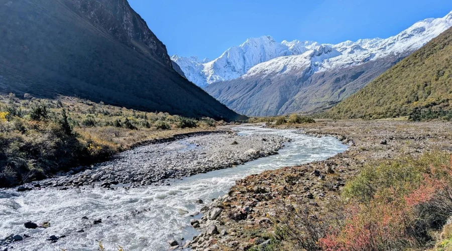
The Manaslu region sits in the northern section of Nepal’s Gorkha district near the Tibetan border. Unlike Everest or Annapurna, this area remains comparatively isolated, with fewer settlements, limited road access, and stricter permit controls. When planning your Manaslu trek Nepal, understanding the terrain matters as much as physical preparation. The route crosses deep river gorges, landslide-prone trails, alpine valleys, and one of the highest trekking passes in Nepal.
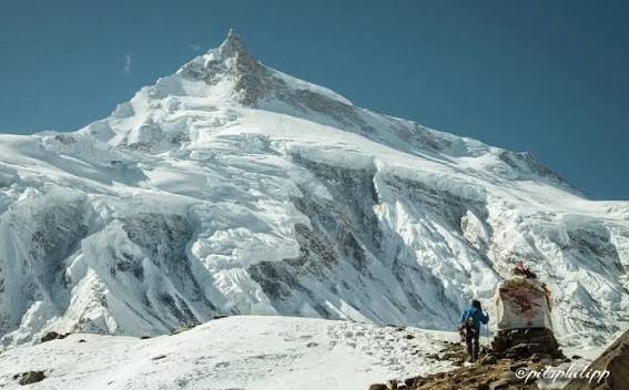
The circuit surrounds Mount Manaslu, the eighth-highest mountain in the world at 8,163 meters. The trekking route moves through the Budhi Gandaki river system before climbing into high Himalayan terrain near the Larkya La pass. This transition from humid lowlands to exposed alpine ground defines the character of the trek.
Unlike the Everest region, where flights access the trailhead directly, Manaslu requires a long overland approach from Kathmandu into the Gorkha district. The region also falls under restricted area regulations, meaning independent trekking is not legally permitted in most sections of the route.
The Geography of the Manaslu Circuit
The geography of the Manaslu circuit location is shaped by the Budhi Gandaki river valley. This river cuts directly through steep Himalayan terrain, creating narrow gorges, unstable cliffs, and long suspension bridge crossings.
The trail starts in lower subtropical zones where temperatures remain warm and humid. Rice terraces, waterfalls, and dense forests dominate the landscape. As the route gains altitude, vegetation changes rapidly.
The terrain shifts through several distinct ecological zones:
- Subtropical river valleys below 2,000m
- Temperate pine and rhododendron forests
- Alpine meadows above 3,500m
- Glacial moraine and tundra near Larkya La
This environmental transition is one reason the trek feels physically demanding. The body adjusts not only to altitude but also to dramatic temperature and terrain changes.
The Budhi Gandaki river valley controls much of the route’s structure. Villages sit along narrow sections of usable terrain beside the river. In many places, the trail is carved directly into cliff faces above the gorge.
During monsoon season, this area becomes unstable due to:
- Landslides
- Trail erosion
- Flooding
- Rockfall
The region remains geologically active because of Himalayan tectonic uplift and constant water erosion.
Manaslu Trek Nepal and the Gorkha District
The Manaslu region lies entirely within Nepal’s historic Gorkha district. This area carries both geographic and cultural significance.
Gorkha district trekking differs from Everest trekking in several ways:
- Less aviation infrastructure
- Fewer permanent lodges
- Longer vehicle access routes
- More isolated settlements
- Reduced rescue accessibility
The district borders Tibet to the north, and Tibetan Buddhist influence becomes stronger as trekkers move higher into the valley system.
Villages such as:
- Sama Gaun
- Samdo
- Lho
- Sho
show strong Tibetan cultural architecture and religious traditions.
Stone mani walls, monasteries, and prayer wheels become increasingly common at higher elevations.
Mapping the Trekking Route to Manaslu
The trekking route to Manaslu forms a large circuit around the Manaslu massif before exiting toward the Annapurna region.
Most itineraries begin after a long drive from Kathmandu to:
- Soti Khola
or - Machha Khola
Road conditions vary depending on season and recent weather damage.
From the trailhead, the route generally follows this sequence:
- Machha Khola
- Jagat
- Deng
- Namrung
- Lho
- Sama Gaun
- Samdo
- Dharamsala
- Larkya La Pass
- Bimthang
- Dharapani
The route circles the mountain counterclockwise before crossing into the Marsyangdi valley system after Larkya La.
The Budhi Gandaki Ascent
The first half of the trek stays closely tied to the Budhi Gandaki river valley. Elevation gain is gradual but constant.
Trekkers cross:
- Suspension bridges
- Cliffside trails
- Forested ridges
- Narrow gorge sections
Humidity remains high in lower areas, especially before Namrung.
Sama Gaun and Acclimatization
Sama Gaun acts as the main acclimatization settlement.
Altitude:
- Approximately 3,530 meters
This village sits below Manaslu’s glacier systems and serves as the staging point for:
- Manaslu Base Camp side hikes
- Pungyen Gompa visits
- Acclimatization walks
The terrain here widens into a glacial valley system compared to the narrow lower gorges.
Larkya La Pass Altitude
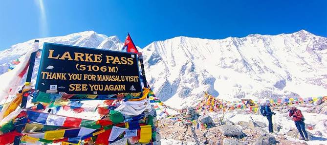
The highest point of the trek is the Larkya La pass altitude:
- Approximately 5,106 meters
This crossing defines the circuit physically and mentally.
The ascent to Larkya La includes:
- Glacial moraine
- Snow-covered sections depending on season
- Strong winds
- Thin air above 5,000m
The descent toward Bimthang is long and physically punishing, especially on tired legs.
Restricted Area Regulations
One of the defining characteristics of remote trekking Nepal regions like Manaslu is permit control.
The Manaslu region requires:
- Restricted Area Permit (RAP)
- Manaslu Conservation Area Permit (MCAP)
- Annapurna Conservation Area Permit (ACAP)
The Nepal government enforces these restrictions because of:
- Border proximity to Tibet
- Environmental protection
- Trail management
- Tourism regulation
Independent solo trekking is not legally permitted in the restricted section.
Trekkers must:
- Travel with a licensed guide
- Trek in a minimum group of two foreigners
- Obtain permits through a registered trekking agency
This is not an optional guideline. Checkpoints along the route regularly inspect documentation.
Why the Trek Feels Remote
Remote trekking Nepal routes differ sharply from commercial trekking corridors like Everest Base Camp.
In Manaslu:
- Villages are smaller
- Lodges are more basic
- Communication networks remain limited
- Rescue logistics are slower
- Medical access is minimal
Weather also impacts evacuation capability. Helicopter access depends heavily on visibility and terrain conditions.
Once beyond Jagat, the sense of isolation increases significantly.
Some trail sections remain several hours away from road access even today.
Environmental Conditions and Glacier Changes
The Manaslu region is changing due to climate and infrastructure development.
Glacial retreat has affected:
- Seasonal snow coverage
- Water flow patterns
- Trail stability
Higher temperatures have also increased:
- Rockfall frequency
- Seasonal flooding
- Ice melt instability
At lower elevations, expanding roads continue to alter sections of the traditional trail.
Despite these changes, large portions of the circuit remain rugged and physically demanding.
The terrain requires:
- Strong endurance
- Controlled pacing
- Proper acclimatization
- Reliable logistics planning
This is not a trek where poor preparation stays hidden for long.
Weather Variability Along the Route
The weather changes sharply with altitude.
Lower elevations near Machha Khola:
- Warm
- Humid
- Rain-prone during monsoon
Mid-altitude villages:
- Cooler mornings
- Stable spring and autumn conditions
High alpine zones near Larkya La:
- Strong winds
- Sub-zero nighttime temperatures
- Sudden snowfall
Spring and autumn remain the primary trekking seasons because visibility and trail stability are more reliable.
Winter crossings are possible but require stronger cold-weather preparation and flexible scheduling.
FAQ
Where exactly is the Manaslu Circuit located?
The circuit lies in Nepal’s Gorkha district near the Tibetan border inside the Manaslu Conservation Area.
Do I need a special permit for this location?
Yes. Trekkers need a Restricted Area Permit along with MCAP and ACAP permits.
Is Manaslu more difficult than the Everest Base Camp trek?
For most trekkers, yes. The terrain is more isolated, the infrastructure is less developed, and the Larkya La crossing adds a more demanding high-pass section.
How does the weather vary along the route?
The trek moves through multiple climate zones, from humid river valleys to freezing alpine terrain above 5,000 meters.
Can I do this trek solo?
No. Nepal regulations require at least two foreign trekkers and a licensed guide for the restricted area section.
What is the highest point on the Manaslu trek?
The highest point is Larkya La Pass at approximately 5,106 meters.
Final Thoughts
The Manaslu circuit location is defined by river systems, high mountain passes, and restricted Himalayan terrain. The route follows the Budhi Gandaki river valley deep into the northern Gorkha district before crossing the exposed Larkya La pass into the Annapurna region.
This is one of Nepal’s most physically demanding trekking circuits because of its isolation, terrain variability, and altitude progression. Unlike heavily commercialized trekking regions, Manaslu still requires careful logistical planning and strict adherence to regulations.
The location of Manaslu is remote, and the terrain requires strict adherence to permit regulations and acclimatization. Trekking here is not a DIY task. At Nepal Adventure Trail, we handle the restricted area permits and the complex logistics of the Manaslu Circuit, ensuring your focus remains on the trail, not the paperwork.