
Last updated: August 30, 2026, Nepal-China Flash Flood. Figures below are drawn from the most recent Nepal Police bulletins and international reporting available at the time of writing. Casualty and missing-person counts have moved daily since the disaster and should be read as a snapshot, not a final tally. Where sources disagree slightly, we’ve noted it.
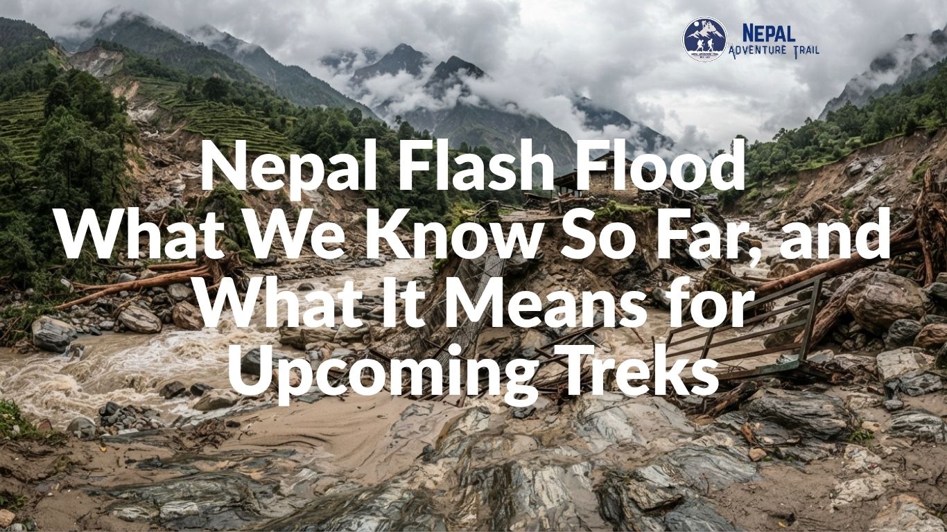
On the morning of August 26, 2026, a flash flood tore down from the Nepal-Tibet border into Rasuwa district, devastating the settlements of Timure and Syabrubesi before surging downstream through the Trishuli River corridor into Nuwakot, Dhading, Gorkha, and beyond. It is one of the deadliest disasters to hit Nepal’s northern trekking regions in decades, and the search for survivors is still active as we publish this.
Our thoughts are with everyone affected, with the families still waiting for news of missing relatives, and with the rescue teams who have been working the river since Wednesday morning.
The Human Toll
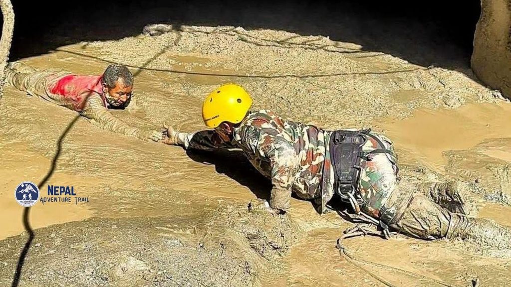
As of the most recent Nepal Police bulletin (Saturday, August 29, 4:00 p.m. Nepal time), at least 669 people have been confirmed dead and around 2,362 remain listed as missing in Nepal, with an additional 7 confirmed dead and 554 missing on the Tibetan side of the border. Some outlets citing slightly earlier bulletins report figures closer to 626 dead and 1,924 missing on the Nepal side; the gap reflects how quickly the numbers have moved, not a factual disagreement. More than 4,000 people have been rescued so far, including a group of over 100 workers pulled from tunnels at a hydropower project in Rasuwa.
It’s worth understanding what “missing” means in a disaster like this. A large share of that number reflects people who are simply out of contact because phone networks and electricity are still down across affected settlements, not necessarily people who have died. Officials have said as much directly, and the number has been described as likely to fall as communication is restored to isolated areas, even as the confirmed death toll continues to rise from recovered bodies.
The toll has climbed sharply and steadily since Wednesday: officials reported 22 dead on the evening of the flood itself, 95 by that night, 389 the following day, 469 the day after that, and past 600 by Friday. At least 466 people have been injured, with many being treated at hospitals near the disaster zone and additional medical teams sent from Kathmandu-area hospitals to support local capacity. Among the missing are security personnel from the Nepali Army, Nepal Police, and Armed Police Force, hydropower workers, customs and immigration staff at the Rasuwagadhi border crossing, trekking guides, and both foreign and domestic tourists. Bodies have been recovered as far downstream as Gorkha, Tanahun, Chitwan, and the Nawalparasi districts, well over 80 kilometers from where the flood originated.
What Caused It
The flash flood event began at roughly 8:40 a.m. on August 26, when a large section of glacier and rock broke away from a cliff face on the northern side of Langtang Lirung, a peak of approximately 7,200 meters near the Nepal-Tibet border. The collapsing mass fell into the Lhende Khola on the Tibetan side of the border and dammed the river. When that debris dam gave way shortly afterward, it released a fast-moving surge of ice, rock, sediment, and water down into the Bhote Koshi River, and from there into Nepal.
The speed of the initial surge is a large part of why warning time was so short. Scientists studying the event estimate the flow covered its first 22 kilometers of descent at speeds around 190 kilometers per hour, reaching the Nepal border in well under seven minutes from the point of collapse. Where the surge reached the Trishuli River, officials reported the water level rising as much as nine meters, or roughly 30 feet, in just thirty minutes. Satellite analysis suggests flood-related discoloration extended up to 80 kilometers downstream, with floodwaters reaching settlements as high as 80 meters above normal river level in the worst-hit sections, and depositing well over a meter of silt across the main disaster zone.
The collapse itself registered as a magnitude 5.2 seismic event, detected by seismometers as far away as the United States and Germany. Early reports mistakenly attributed this to a magnitude 4.4 earthquake; the U.S. Geological Survey later clarified that the seismic signal came from the landslide itself, not a separate tectonic earthquake. On August 28, a secondary barrier lake formed by debris from the initial collapse breached its banks, briefly halting rescue operations on both sides of the border over fears of a second surge. As of the most recent update from Nepal’s Department of Hydrology and Meteorology, the immediate risk of a further lake-burst event has eased, though authorities continue to monitor the site closely.
This is not an isolated event for this specific stretch of river. According to disaster risk specialists at ICIMOD, the Lhende Khola has now flooded twice in fourteen months. A similar, smaller flood struck the same Timure-Syabrubesi corridor on July 8, 2025, killing at least nine people, leaving nineteen missing, sweeping away the Miteri Bridge connecting Nepal and China, and damaging the Rasuwagadhi dry port and nearby hydropower infrastructure. Researchers are treating the recurrence at the same site as a signal worth taking seriously for future risk planning in the valley, even as the exact contribution of glacial retreat, monsoon rainfall, and slope instability in this specific event remains under technical investigation.
Infrastructure and Downstream Damage
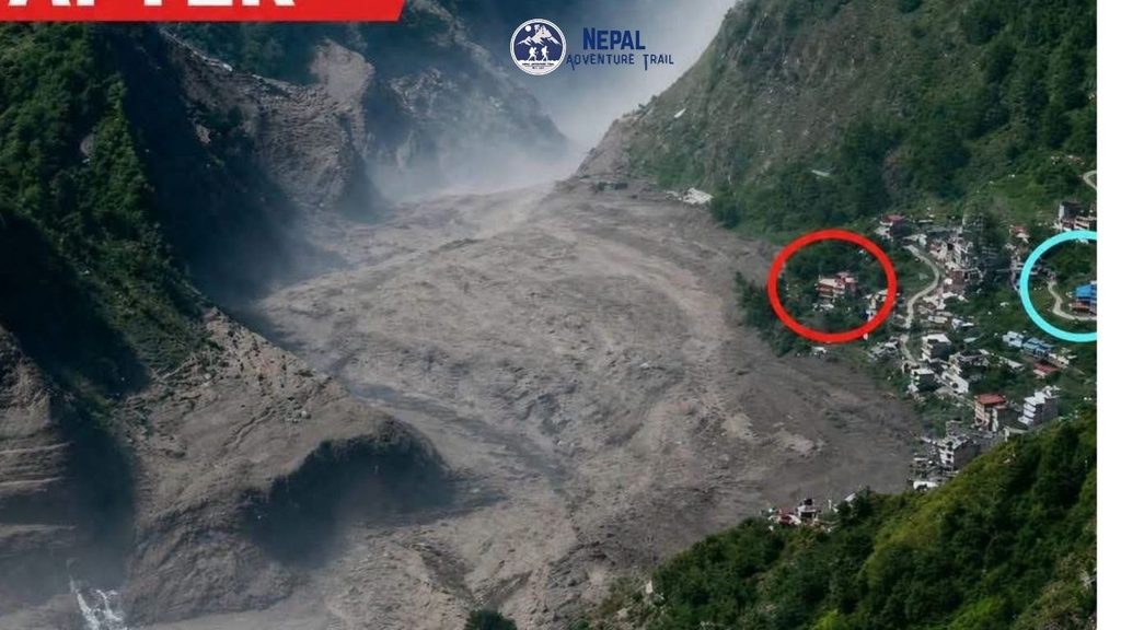
The damage extends well beyond the immediate flood zone. Officials have confirmed that at least 19 to 32 motorable bridges (estimates vary by source and are still being finalized) and somewhere between 25 and 40 kilometers of road have been destroyed or swept away, including the entire stretch of road connecting Betrawati in Nuwakot to the Rasuwagadhi border crossing. The Rasuwagadhi customs office and dry port, a key node for Nepal-China border trade, was effectively destroyed. Fourteen hydropower projects sustained damage, and transmission infrastructure across the corridor has been knocked out, cutting power to large sections of the affected districts.
Downstream, the Trishuli River carried the flood’s effects through Nuwakot and Dhading, with floodwater entering Timure, Dhunche, Mailung, Syabrubesi, Betrawati, Trishuli Bazaar, and Devighat. Dhunche, worth noting specifically, is the district headquarters of Rasuwa and the usual gateway town for the Gosaikunda trek, which shares much of its access road with the Langtang route. Entire riverside communities have been affected; aid organizations report that one settlement of roughly 250 households, resettled along the Trishuli banks after being displaced by the 2015 earthquake, has been swept away in its entirety.
The Nepal government’s preliminary damage estimate stands at roughly Rs 200 billion. The Prime Minister’s Office has confirmed Rs 5.04 billion deposited across nine commercial bank accounts to fund relief and rescue operations. Humanitarian organizations including CARE, World Vision International, and the Nepal Red Cross have begun emergency response work, with immediate concerns now shifting toward shelter, clean water, and the risk of waterborne disease outbreaks given the extent of damaged water and sanitation infrastructure across the affected districts.
What This Means for Specific Trekking Routes
For anyone with a trip planned in the region, the practical distinctions matter more than the overall scale of the disaster.
Langtang Valley Trek: The trekking trail itself, which climbs east from Syabrubesi into the Langtang Valley, has not been reported as directly damaged. The problem is access: the road into Syabrubesi and the surrounding infrastructure have been severely hit, and Syabrubesi itself sits at the center of the disaster zone. Reaching the trailhead safely is currently the open question, not the condition of the trail beyond it.
Gosaikunda Trek: Because this route shares its main access corridor through Dhunche, and Dhunche was among the settlements affected by floodwater, travelers should treat Gosaikunda access as similarly uncertain until the road situation is independently confirmed.
Tamang Heritage Trail: This route also typically begins from or near Syabrubesi before branching toward villages like Gatlang and Tatopani. The same access constraints affecting Langtang apply here.
Manaslu Circuit Trek: This route follows the Budi Gandaki River, a separate watershed from the Trishuli and Bhote Koshi systems affected by this flood. No direct trail damage has been reported for Manaslu as a result of this specific event, though regional road conditions elsewhere in the country should still be confirmed given the scale of disruption.
We want to be direct about the limits of what we can tell you from a distance: aerial and on-the-ground assessments are still underway in several of these areas, and conditions along shared access roads can change within days as repair work progresses or as further landslide risk emerges. Treat everything above as the picture as of this week, not a permanent status.
If You Have an Upcoming Trek Booked
- Contact your trekking operator or guide directly for a current, route-specific assessment before you travel. Don’t rely on itineraries or blog posts written before August 26.
- Check Nepal’s Department of Hydrology and Meteorology (DHM) for official river-level and rainfall data before heading into any river-adjacent section of trail.
- Check Nepal Police bulletins for verified casualty, rescue, and road-status updates rather than secondhand reports or social media.
- If you’re already in Nepal and scheduled to depart for this region soon, expect delays, and be prepared for your operator to propose an alternate route, a delayed start, or a different trek entirely this season.
- If you’re trying to reach someone who may have been in the area, Nepal Police and the disaster hotline are the official channels for missing-person reports; avoid spreading unverified names or photos through informal channels, which has reportedly complicated identification efforts elsewhere in past disasters.
If you’re trekking with us and have a booking anywhere in this region, please contact your coordinator directly rather than waiting on updates to this page. We’ll have information specific to your itinerary faster than a general update can provide.
The Broader Picture: Monsoon-Season Risk in Nepal’s Himalayan River Valleys
This event is extreme by any measure, but it sits inside a pattern worth understanding if you trek through Nepal’s northern, glacially fed valleys during the monsoon and shoulder seasons. Rivers like the Trishuli, Bhote Koshi, and Budi Gandaki all run through steep, narrow gorges below high-altitude glaciers and unstable slopes. A landslide dam, a glacial lake outburst flood, or an intense cloudburst well upstream, sometimes across the border in Tibet, can raise water levels far faster than local rainfall would ever suggest. It’s entirely possible to be standing in clear weather at a teahouse and still be at direct risk from something that happened an hour’s flow-time upstream.
This is not a reason to avoid these valleys outright, and it’s not new information to anyone who has read about glacial lake outburst floods, or GLOFs, as a recurring hazard across the Hindu Kush Himalaya region. It does mean a few habits carry more weight here than on lower-risk trekking routes: traveling with an operator who maintains active contact with local authorities and river-monitoring data, avoiding travel through river-adjacent sections during or immediately after heavy monsoon rainfall, and treating any sudden change in a river’s color, sound, or flow rate as an immediate signal to move to higher ground rather than to stop and investigate.